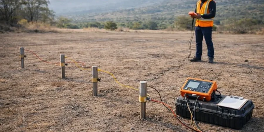
The Los Angeles Basin sits on a deep sequence of Quaternary alluvium — over 10,000 feet of interbedded sands, silts, and clays in places — deposited by the Los Angeles, San Gabriel, and Santa Ana Rivers. This geological layering creates sharp contrasts in electrical resistivity that we map daily. A clean sand aquifer might read 50–200 ohm-m, while the fine-grained lakebed sediments common under downtown LA drop below 15 ohm-m. Detecting those boundaries before excavation or drilling saves project time. We run Vertical Electrical Sounding surveys using Schlumberger arrays with electrode separations from 1.5 meters out to 300 meters, resolving layers to depths of roughly one-third the total array spread. In a city where groundwater basins underlie nearly 4 million people, knowing where the water table sits — and whether it's perched, confined, or contaminated — is not optional.
A VES sounding doesn't just find water — it discriminates between fresh, brackish, and saline groundwater before anyone puts a drill bit in the ground.
Process overview
Los Angeles sits at roughly 285 feet above sea level near the Civic Center, but the terrain climbs fast — from zero at the Port to over 5,000 feet in the San Gabriels within 30 miles. That gradient drives groundwater flow and salinity patterns that electrical methods pick up clearly. Our field crew uses a 4-electrode Wenner or Schlumberger array with an ABEM Terrameter system, switching to dipole-dipole when lateral resolution matters more — say, mapping a saltwater intrusion front near Long Beach Harbor. We stack readings until the coefficient of variation drops below 3 percent, which matters in LA's electrically noisy environment: power lines, buried utilities, cathodic protection on pipelines all inject stray current. Post-processing runs through RES2DINV for 2D inversion or IPI2Win for 1D VES curves, matching field data against layered-earth models. For sites where the bedrock — typically the Fernando or Puente Formation — lies within 100 feet, resistivity contrasts between weathered and competent rock guide excavation depth decisions directly.
Local geotechnical context
Compare a site in the San Fernando Valley — thick alluvium, water table at 30 to 80 feet — with one in the Palos Verdes Peninsula, where the Altamont Shale sits near surface and groundwater is scarce and brackish. The San Fernando site gives clean resistivity layering: dry alluvium above the water table reads high, saturated sands drop to moderate values, and clay lenses show as conductors. Palos Verdes is trickier. Shale resistivity overlaps with saline pore water, so distinguishing lithology from fluid conductivity requires a petrophysical cross-check — we often pair a VES line with a single CPT sounding for ground-truth. The biggest risk we see across LA is misinterpreting a low-resistivity zone as contamination when it's actually natural clay — the Puente Formation marine shales under eastern LA County can read below 10 ohm-m with zero anthropogenic impact. Getting that wrong triggers unnecessary remediation costs. Saline intrusion in coastal aquifers from Santa Monica to Long Beach adds another variable; resistivity monitoring over time tracks the freshwater-saltwater interface movement driven by pumping and drought recharge cycles.
Common questions
What does a VES survey cost in Los Angeles?
A typical single-sounding VES survey in Los Angeles runs between US$590 and US$1,070, depending on the maximum electrode spread needed, site accessibility, and the number of soundings. Sites requiring traffic control, difficult terrain access on hillside lots, or long cable runs through urban corridors add mobilization time and push toward the upper end of that range.
How deep can electrical resistivity soundings reach in LA Basin soils?
With a Schlumberger array spread of 300 meters, we routinely resolve layers to roughly 100 meters depth in favorable conditions — meaning dry surface soils and moderate background noise. In the LA Basin's deep alluvial fill, that covers the entire Holocene and upper Pleistocene sequence. Depth of investigation is approximately one-third of the total current electrode separation (AB/3).
Can resistivity surveys detect groundwater contamination?
Yes, but with an important caveat: resistivity responds to total dissolved solids in pore water, not to specific contaminants. A gasoline plume from a leaking UST on a former industrial lot in Vernon will show as a high-resistivity anomaly because hydrocarbons are electrically resistive. In contrast, a brine plume or landfill leachate reads very low. We always recommend pairing resistivity with direct sampling — at least one monitoring well or CPT push — to calibrate the geophysical response to actual fluid chemistry.
How long does a VES field survey take on a typical LA commercial site?
For a half-acre commercial lot with a single 200-meter Schlumberger sounding, expect 2 to 3 hours of field time plus 30 minutes for setup and breakdown. Multiple parallel lines for 2D tomography on the same site might run 5 to 6 hours. Urban electrical noise from nearby power lines or active construction can require additional stacking time, adding 30 to 60 minutes to the survey.